Everyone learning the open category memorises the same number: 120 metres. It is the easiest rule on the exam to recite and one of the easiest to break in the air, because the part people get wrong is not the number. It is what the 120 metres is measured from. Get that wrong and you can be flying perfectly legally on your controller's altitude readout while being well outside the law over the ground below.
Here is what the regulation actually says, why your drone's height display can mislead you, the one exception that lets you go higher, and why a flight-zone approval in Latvia does not buy you a single extra metre.
The rule, word for word
The height limit lives in Regulation (EU) 2019/947, Annex Part A, point UAS.OPEN.010(2). It says the unmanned aircraft "shall be maintained within 120 metres from the closest point of the surface of the earth," and that "the measurement of distances shall be adapted accordingly to the geographical characteristics of the terrain, such as plains, hills, mountains."
Read that phrase slowly: the closest point of the surface of the earth. The 120 metres is measured from the ground (or water) directly beneath the drone — not from where you took off, and not from sea level. CAA Latvia states the same limit plainly for the open category: 120 metres, measured from the ground or water surface.
That is the whole rule for flat ground. The complication starts the moment the terrain stops being flat.
Why your drone's altitude reading can lie to you
Almost every GPS drone shows its height relative to the take-off point — the spot where you powered up and the home point was set. On a level field that matches the law exactly. On a slope it does not.
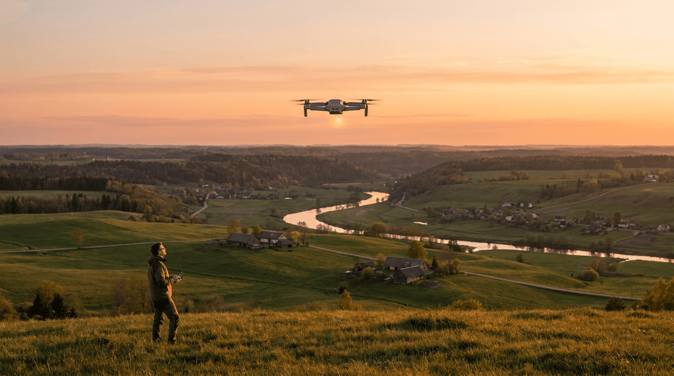
Picture standing on a hilltop and flying out over a valley that drops away beneath you. Your screen says 110 metres and climbing slowly; you feel safe. But the valley floor is 80 metres below your launch point, so the drone is actually around 190 metres above the surface under it — far over the limit. The reverse is just as real: fly uphill and the rising ground can catch up to a drone your screen says is at 120 metres, until it is only a few metres above the slope.
This is exactly what "adapted to the geographical characteristics of the terrain — plains, hills, mountains" is written to cover. The legal ceiling follows the ground. You are expected to fly the contour, not a flat ceiling pinned to your launch altitude. Over genuinely uneven ground, that means watching the terrain under the aircraft, not just the number on the screen.
The one way to legally exceed 120 metres in the open category
There is a single exception, and it is narrow. Point UAS.OPEN.010(3) allows it: when flying within a horizontal distance of 50 metres from an artificial obstacle taller than 105 metres, the maximum height "may be increased up to 15 metres above the height of the obstacle" — but only "at the request of the entity responsible for the obstacle."
This exists for a practical reason: inspecting tall structures — a 150-metre chimney, a wind turbine, a telecom mast, a high-rise. To check the top safely you have to fly above 120 metres, so the rule lets you go up to 15 metres above the structure, but only when you stay within 50 metres of it horizontally.
Note the condition that turns it from a loophole into a real exception: the increase must be requested by whoever is responsible for the obstacle. You cannot decide on your own to use a nearby tower as a licence to climb. The obstacle's owner has to be in the loop. For ordinary recreational flying, this exception will essentially never apply.
There is also a small derogation for unmanned sailplanes under 10 kg (UAS.OPEN.010(4)): they may fly beyond 120 metres from the surface, provided they are never more than 120 metres above the remote pilot. It is a niche rule for model gliders, not for camera drones.
Beyond those two cases, the open category gives you no path above 120 metres. Going higher means leaving the open category for the specific category, which requires an operational authorisation built on a risk assessment — not something you do on a whim for a better shot.
In Latvia: zones can lower it, and an approval does not raise it
The 120-metre ceiling is the EU default, but it is a ceiling, not a guarantee. CAA Latvia notes that individual UAS geographical zones may set other height limits — usually lower. Near aerodromes, over certain areas, or inside restricted zones, the legal maximum can drop well below 120 metres or disappear entirely. Checking those zones before takeoff is a pre-flight step, not an afterthought; we walk through them in no-fly zones in Latvia and UAS geographical zones.
Here is the part that catches people. Getting a flight request approved in BGKIS for a restricted zone does not let you exceed 120 metres. CAA Latvia is explicit: a zone approval does not grant the right to deviate from the regulation's basic requirements — such as the 120-metre height or VLOS. It only lifts the restriction specific to that zone. The approval buys you access to the zone; it does not buy you altitude. To fly higher than 120 metres you still need the specific category, approval or not.
Why this is on the A1/A3 exam
The height limit is a named item in the A1/A3 theory syllabus, and it carries the whole safety case for the open category. Crewed aviation lives above a floor; small drones are confined below it, and the two layers are not supposed to overlap. A drone held at 120 metres above the surface and an airliner on approach are designed never to be able to meet — a separation that only works if every pilot treats the ceiling as a hard limit. We looked at what happens when that line is crossed in the airliner near-miss and the altitude rules.
The exam tends to test the precise version: that the 120 metres is measured from the closest point of the surface, that terrain changes where that ceiling sits, and that geographical zones can push it lower. The candidate who only remembers "120" misses the question that asks 120 metres from what.
Quick reference before you launch
- 120 metres, from the surface below the drone — not from your take-off point and not from sea level.
- The ceiling follows the terrain. Flying downhill into a valley, you must descend to stay within 120 m of the ground beneath; flying uphill, the slope rises toward you.
- Your screen usually shows height above launch. On sloped ground that is not the legal figure — watch the terrain, not just the number.
- Obstacle exception: within 50 m of an artificial obstacle taller than 105 m, up to 15 m above it — but only at the request of the entity responsible for the obstacle.
- Zones can lower the limit. Check the geographical zones in Latvia before every flight.
- A zone approval does not raise the ceiling. 120 m and VLOS still apply; going higher needs the specific category.
FAQ
What is the maximum height for a drone in the EU open category? 120 metres, measured from the closest point of the surface of the earth — effectively the ground or water directly below the drone. It is set by Regulation (EU) 2019/947 and applies across the EU; CAA Latvia publishes the same figure for the open category.
Is 120 metres measured from the ground or from where I took off? From the ground (or water) beneath the aircraft, adapted to the terrain. It is not measured from your launch point. On a slope, the two diverge — which is why a drone that reads 120 metres on your controller can be well over the surface in a valley below.
Can I ever fly above 120 metres in the open category? Only in one narrow case: within 50 metres of an artificial obstacle taller than 105 metres, you may go up to 15 metres above it — and only at the request of the entity responsible for that obstacle. For anything else, flying higher means moving into the specific category with an operational authorisation.
Does a BGKIS flight approval let me fly higher than 120 metres? No. A zone approval only lifts the restriction tied to that specific zone. It does not let you deviate from the regulation's basic requirements like the 120-metre height limit or VLOS. To exceed 120 metres you still need the specific category.
How does 120 metres compare to the US 400-foot limit? They are essentially the same ceiling: 120 metres is roughly 400 feet (about 394, to be exact). The framework differs, but the altitude floor that keeps small drones clear of crewed traffic is set at close to the same height on both sides.
The 120-metre rule looks like the simplest line in the open category, and the number is. What trips pilots up is the surface it is measured from and the zones that can lower it. Once that is clear, line it up with the open category A1, A2 and A3 and what the A1/A3 exam in Latvia expects, then drill the altitude and airspace questions in the practice sets — "120 metres from what" is exactly the kind of question that looks obvious until you have to name the surface.