A single aerial photo shows a site. A mapping flight measures it. That difference — from a picture to a dataset you can put a scale bar on — is what separates drone photography from drone mapping and surveying, and it's why the two use almost none of the same workflow. This article covers what a mapping flight actually produces, what makes the result accurate enough to build decisions on, who buys it, and where the legal ceiling sits.
What a mapping flight actually produces
A mapping flight doesn't take a handful of hero shots. It flies a grid over the site, back and forth at a constant altitude, firing the camera on a fixed interval so that every frame overlaps its neighbours on all sides. Photogrammetry software then matches thousands of shared points across those overlapping images and reconstructs their positions in three dimensions — the same principle stereo vision uses, run at industrial scale.
Two deliverables come out of that reconstruction:
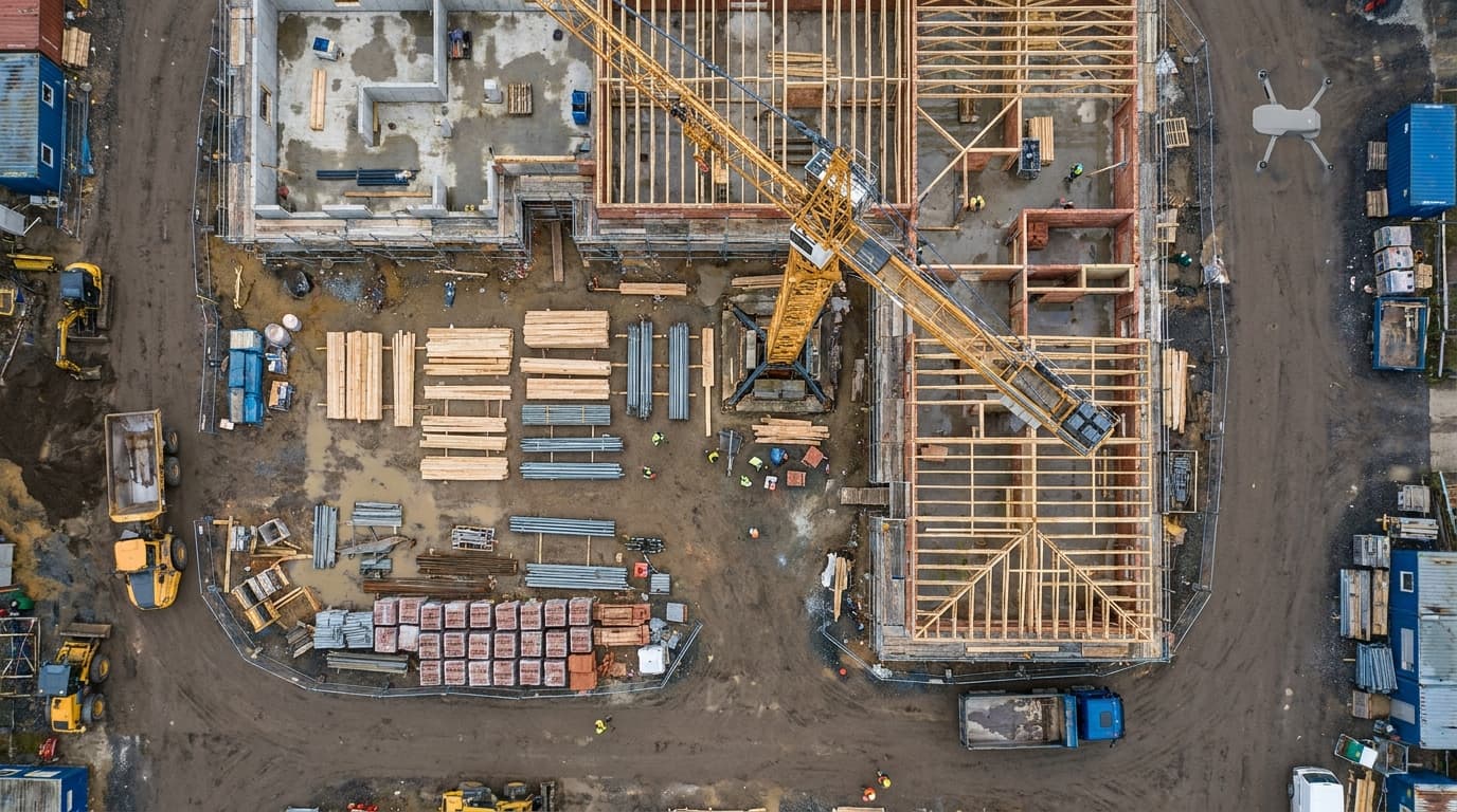
- Orthomosaic. A single, geometrically corrected top-down image of the whole site, stitched from the source photos and projected as if every point were viewed straight down. Unlike a raw photo, distances and areas measured on an orthomosaic are real — that's what makes it usable as a basemap rather than just a picture.
- 3D surface model. The same point matches also yield a point cloud, a digital surface model (DSM), or a mesh — a 3D representation of the terrain and everything on it: buildings, stockpiles, vegetation. From this you can pull elevation profiles, cut-and-fill volumes, and contour lines without setting foot on site.
Neither product is decorative. Both are meant to be measured, not just looked at — and that's exactly where accuracy stops being a nice-to-have.
What makes the result accurate
Accuracy in mapping isn't a camera spec. It's a chain of decisions made before, during and after the flight, and any weak link caps the whole result.
Overlap and ground sampling distance
Overlap — how much each photo shares with the one before and beside it — is what gives the software enough shared points to triangulate reliably. Too little overlap and the reconstruction gets thin or breaks entirely over featureless surfaces like flat gravel or water. Ground sampling distance (GSD) is the real-world size each pixel represents; it's set by altitude and sensor, and it caps how fine a detail the model can resolve — a crack in a wall needs a smaller GSD than a stockpile volume does. Higher overlap and finer GSD both mean more images and more flight time, so the planning question is always "how much detail does this deliverable actually need," not "as much as possible."
Ground control points
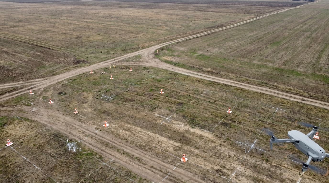
A model built from photos alone is internally consistent — shapes and relative distances are right — but it can still float in the wrong place or at the wrong scale relative to the real world. Ground control points (GCPs) fix that: physical markers laid on site and measured with a surveyed instrument, then matched to the same points in the images. They anchor the model to known coordinates and are still the most reliable way to guarantee absolute accuracy, especially where a client needs the output to align with existing survey data or cadastral records.
RTK and PPK
Real-Time Kinematic (RTK) and Post-Processed Kinematic (PPK) positioning correct the drone's own GPS location using a base station or a correction network, instead of relying on standard satellite positioning alone. A drone flying with RTK or PPK already knows where each photo was taken far more precisely, which reduces — though doesn't always eliminate — how many GCPs the site needs. It's a way of moving some of the accuracy work from the ground crew to the aircraft, not a replacement for control on every job.
Flight discipline
None of the above survives sloppy flying. A steady altitude, consistent lighting across the mission (flat overcast beats harsh midday shadows), and enough wind margin to avoid motion blur all matter as much as the equipment. A technically capable drone flown carelessly produces a model that looks fine and measures wrong.
Who buys mapping data
The deliverables above map onto a specific set of buyers, not a general "aerial content" market:
- Construction — progress tracking against a plan, cut-and-fill volumes for earthworks, as-built documentation.
- Mining and quarries — stockpile volume reports, run on a repeat schedule instead of manual survey.
- Agriculture — field-level crop and canopy analysis, usually paired with a multispectral sensor rather than a standard camera.
- Land surveying and cadastral support — orthomosaics and elevation data feeding into work a licensed surveyor still signs off.
- Infrastructure and utilities — corridor mapping along roads, pipelines and power lines, where a consistent basemap over time matters more than any single flight.
- Insurance and disaster assessment — before/after comparisons of a site after a storm, flood or fire.
What these buyers have in common: they need a dataset that holds up months later against another dataset, not a set of pretty stills. That's the same discipline aerial photos for a property listing don't require — a listing shot has to look good once; a mapping dataset has to measure right every time.
The legal layer: why big sites hit VLOS before they hit the sensor
Mapping flights cover ground that a single photo shoot never does, and that's exactly where the regulation bites first. The remote pilot has to keep the drone within visual line of sight throughout the flight — no binoculars, no first-person video feed as a substitute — which sets a hard limit on how large an area one operator can cover from one position, regardless of how good the mapping software is. Large sites either get flown in sections from multiple vantage points, use an observer to extend effective coverage, or, for genuinely large or repeat-flown corridors, move into the Specific category with an operational authorisation built on a documented risk assessment.
The subcategory question sits alongside that. Most mapping work over open ground with no bystanders nearby fits the Open category's A3 subcategory, keeping well clear of people. A site with public access, nearby buildings, or a requirement to fly beyond visual line of sight pushes the operation past what Open allows — at that point the drone class, the operator's registration, and the remote pilot's qualification all have to match the actual operation, not the easiest one to claim. None of this is exotic paperwork invented for mapping specifically; it's the same category logic that governs starting a drone business in any commercial niche — mapping just tends to hit the ceiling sooner because the sites are bigger.
What matters now
Accuracy in drone mapping is a workflow, not a spec sheet: overlap planned for the deliverable, ground control placed and measured properly, RTK or PPK used where it earns its cost, and flights disciplined enough that the model means what it claims to mean. The limiting factor on most jobs isn't the sensor — it's whether the site can be covered within visual line of sight under the Open category, or whether it genuinely needs a Specific-category authorisation. Sort the legal side before quoting the flight time.
Next step: if you're building toward commercial mapping work, get the qualification layer right first — start with the free A1/A3 exam and prepare with the dronelingo course.