Most drone navigation systems still assume that positioning gets easier when you add more compute, more memory, and a better map. The Bee-Nav work published by TU Delft and collaborators in Nature asks a harder question: what if getting home does not need a full map at all?
That question matters because many small drones still struggle where GPS is weak or compute is tight. Warehouses, greenhouses, hangars, forests, and rough outdoor sites are exactly the places where "just use GNSS and a heavy perception stack" becomes expensive, fragile, or both. Bee-Nav is interesting because it comes at the problem from a different angle. Instead of building a detailed map, the drone first flies a short learning flight near home, stores a small visual memory, and later uses that memory to correct navigation drift on the way back.
This is not a universal autonomy breakthrough. It is narrower than that. But it is also more useful than many autonomy headlines, because it solves a specific problem on a surprisingly small memory budget.
Bee-Nav is a return-home strategy, not a full navigation stack
The easiest way to misread this research is to treat it as "drones can now fly anywhere without GPS." That is not what the paper shows.
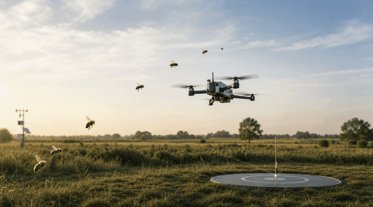
Bee-Nav is mainly a homing system. The drone learns what the area around home looks like during a short exploratory flight. After that, it can leave, fly an outbound mission, and then try to come back. On the return leg it combines two ideas:
- odometry, an internal estimate of how far and in which direction it has moved
- visual memory, a learned sense of what the surroundings near home should look like
This split matters. Odometry helps keep a rough home vector across a long outbound and inbound flight, but it drifts over time. Visual homing then corrects that built-up error as the drone gets closer to home.
That logic comes straight from honeybees. Bees do not carry detailed metric maps the way robotic SLAM systems often do. Instead, they combine movement-based estimates with learned visual cues around important places such as the hive.
Why the memory footprint matters
The most striking part of the research is not just that the drone found its way back. It is how little memory the system needed to do it.
According to the TU Delft release, the larger outdoor experiments used a neural memory of only about 42 KB. In smaller indoor homing tests, the network was even smaller, around 3.4 KB. That is tiny next to the compute and storage that many modern navigation pipelines expect.
This matters because lightweight drones pay for every extra gram, watt, and bit of heat. A homing method that runs on very limited hardware is strategically different from a navigation stack that only works once the aircraft carries a heavier onboard computer.
The paper also reports that the method can learn from a fairly small area around home rather than from the whole mission area. In other words, the drone does not need a dense map of the entire environment. It only needs enough local visual structure near home to work out which way "home" lies when it sees the area again.
What the experiments actually showed
The Nature paper and the TU Delft summary describe a progression from small indoor tests to larger indoor and outdoor trials.
The system was tested in:
- a small indoor arena for controlled validation
- larger indoor spaces such as hangars
- a small outdoor field with clear cues around the edges
- a much larger outdoor area at Unmanned Valley in the Netherlands
In the large outdoor trials, the drone reportedly flew more than 600 meters and still made it home on a 42 KB network. The paper also notes that many of the full-flight experiments ended within about 0.5 m of the home position. That is a serious result for such a compact approach.
At the same time, the research does not hide the weaknesses. TU Delft said outdoor success dropped to roughly 70% in windy conditions. The reason was practical and telling: wind forced the drone to tilt, and that made the visual input less useful for homing. This is exactly the kind of detail that separates a promising navigation idea from a field-ready all-weather system.
Why this is different from map-heavy autonomy
A lot of coverage of autonomous drones still collapses navigation into one story: more sensors, more mapping, more AI, more onboard processing. Bee-Nav points the other way.
Instead of asking the aircraft to hold a rich model of the whole world, it asks for something narrower:
- learn a compact visual picture around home
- keep a rough estimate of movement while away
- use the learned views to pull the return path back toward home
That is much closer to an efficient emergency-return or recharge-return capability than to general-purpose autonomous exploration.
This distinction matters commercially. A greenhouse inspection drone, a small warehouse robot, or a lightweight indoor flyer does not always need to rebuild the whole scene. It may just need a cheap, light, robust way to leave a dock or base, do a task, and come back.
The strongest use cases are practical, not cinematic
The TU Delft team points specifically to greenhouse monitoring, and that makes sense. A lightweight drone working around crops and people benefits from two things at once:
- it should not carry an unnecessarily heavy compute stack
- it should be able to return safely to a known home point
The same logic extends to warehouses, indoor inventory checks, and repeated inspection tasks around semi-structured sites. In those settings, the real value is not "autonomy" in the abstract. The value is lower onboard resource demand and a believable way home when GPS is weak, missing, or simply the wrong tool.
This also explains why the paper's limitation to a single home location is not trivial, but also not fatal. Many real workflows already revolve around a dock, a charging station, a launch point, or a recurring base. For those use cases, "can it get back to one known home efficiently?" is often the right question.
What Bee-Nav still does not solve
This is where the hype needs to stop.
Bee-Nav does not mean a drone can now ignore maps, GNSS, and every other navigation method on every mission. The current work still has clear limits.
1. It is centered on one home location
The Nature paper explicitly notes that the present system is limited to a single home location. That is useful for return-to-base logic, but it is not the same as free-ranging navigation between many destinations.
2. It still depends on recognizable visual structure
The method works because the drone can learn and later recognize useful visual cues around home. Uniform, low-texture, fast-changing, or visually ambiguous environments are harder.
3. Wind and aircraft attitude still matter
The 70% outdoor success figure in wind is a reminder that a visually efficient method can still break down when the aircraft's view changes in ways the system does not handle robustly.
4. It is not a complete autonomy stack
Bee-Nav solves homing. It does not solve sense-and-avoid for every environment, mission planning across arbitrary terrain, or the full policy and safety layer around autonomous operations.
Why this matters for the next generation of small drones
The broader importance of Bee-Nav is architectural. It suggests that some navigation problems for small UAVs may be solved better by using less, not more.
That is a serious idea. Small drones do not scale gracefully when every problem gets answered with heavier compute, richer maps, and more power draw. In some roles, especially repeated short missions from a fixed home point, a compact visual homing layer may be worth more than a larger general navigation stack.
It also fits a wider trend in drone autonomy. The most credible systems in 2026 are increasingly the ones that define their mission tightly instead of pretending to solve everything at once. Bee-Nav is credible precisely because it is narrow: get home, on limited hardware, after a short learning flight, without leaning on a full map or GPS.
What to watch next
The next stage for this line of research is not a louder headline. It is robustness.
The key questions now are straightforward:
- can the method handle stronger wind and larger attitude changes?
- how well does it cope when lighting changes sharply?
- how much visual change near home can it tolerate over time?
- can the same idea support multiple home points or dock stations?
- can it integrate cleanly with obstacle avoidance and routine mission autonomy?
If those pieces improve, Bee-Nav or Bee-Nav-like approaches could become very practical for lightweight drones that mainly need dependable homing rather than full-scale world modeling.
Want the bigger market picture around autonomy? Read our analysis of AI-powered autonomous drones in 2026.
FAQ
Does Bee-Nav mean drones no longer need GPS?
No. It means a drone may be able to get home in some GPS-denied situations without relying on a full map. It does not replace every other navigation method.
What is the main idea behind Bee-Nav?
A short learning flight near home, a compact learned visual memory, and odometry to estimate the rough home vector through the rest of the mission.
Why is the 42 KB figure important?
Because it shows the homing logic can run on extremely little memory compared with many map-heavy autonomy stacks.
What is the biggest current limitation?
The present system is centered on a single home location and becomes less robust in tough outdoor conditions such as wind.
Where could this be useful first?
Greenhouses, warehouses, indoor inspection, and other lightweight drone workflows built around a fixed base or dock.
Conclusion
Bee-Nav matters not because it proves drones have solved navigation, but because it proves they may not need to solve it in the most expensive way. A short learning flight, rough odometry, and a tiny visual memory were enough to bring a drone home from hundreds of meters away in the TU Delft experiments. That is not a universal autonomy answer. It is something more interesting: a lean answer to one of the most practical problems small drones still face.